How to Read Latitude and Longitude Without Mixing Them Up
Learn how to read latitude and longitude, decode coordinate formats and check a map pin so you can place a point without confusing north with east.
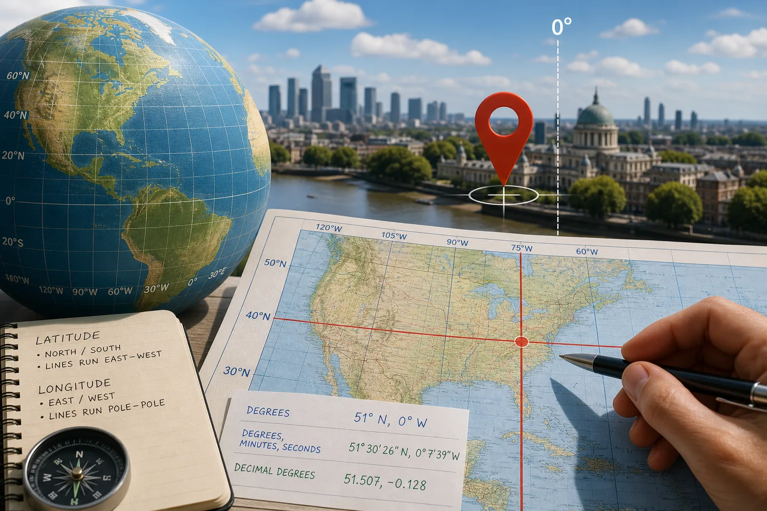
Latitude and longitude give a map pin its north–south and east–west position. In the common latitude-first format, read latitude before longitude, but check the labels: some digital tools put longitude first.
What does latitude tell you?
Latitude measures how far north or south a point lies from the equator, which is 0° latitude. A value of 34° N is north of the equator; 34° S is south. The direction belongs to the coordinate, not to the map’s page orientation.
Lines of latitude run east to west. Follow one and you remain at the same latitude, like tracing a band around a ball. On a north-up map they often look horizontal, though a projection can bend or reshape them.
What does longitude tell you?
Longitude measures a position east or west of the zero meridian. That meridian is conventionally defined as 0° longitude and is associated with the historic line at Greenwich in London. The historic line and the modern reference used in satellite positioning are not precisely identical: they belong to different reference frameworks. For ordinary map reading, the distinction is usually not visible, but the names should not be treated as exact synonyms.
Lines of longitude run from pole to pole and meet at both poles. A point at 12° E lies east of the zero meridian; 12° W lies west. Unlike the equator, the zero meridian is an agreed reference, not a natural dividing line.
How do you read latitude and longitude together?
In latitude-first notation, read the north–south value, then the east–west value. For example, 51° 30′ N, 0° 7′ W places a point north of the equator and west of the zero meridian. Some digital systems reverse the order, so “lat” and “lon” labels are more reliable than position alone.
Decimal degrees commonly use positive numbers for north and east, and negative numbers for south and west. In that convention, 51.5, -0.1 means north of the equator and west of the zero meridian. A pair without labels is ambiguous unless its order and sign convention are known.
Say a paper map shows a latitude–longitude grid and you have 40° N, 75° W. Find the 40° N line and the 75° W meridian; their crossing marks the point. If you swap the values, 75° becomes the latitude and 40° the longitude. That may be invalid for the chosen format or may identify a different location, so a swap cannot reliably diagnose an error. Use labels and the map’s place context instead.
Which coordinate format are you looking at?
Degrees express angular position. Degrees, minutes and seconds divide a degree into 60 minutes and each minute into 60 seconds. The marks resemble clock notation, but here they subdivide an angle.
- Degrees with directions: 51° N, 0° W gives the hemispheres directly.
- Degrees, minutes and seconds: 51° 30′ 26″ N gives a more detailed latitude than a whole-degree value.
- Decimal degrees: 51.507, -0.128 is compact for digital entry when the order and sign convention are known.
On a paper map, compare the coordinate’s units with the grid labels in the margin. If the grid uses degrees and minutes but your coordinate uses decimal degrees, convert the notation or use a mapping tool that accepts both. In a phone map, enter the complete pair, including its direction letters or signs.
What questions help you read a coordinate correctly?
Does latitude always come before longitude?
No. Many written references list latitude first, while some digital systems list longitude first. Follow “lat” and “lon” labels or the format instructions rather than guessing from the order.
What does a negative coordinate mean?
In the common decimal-degree convention, a negative latitude indicates south and a negative longitude indicates west. Without knowing which value is latitude, the signs alone do not tell you the order.
Why might two coordinate grids differ?
Maps can use different coordinate systems or datums, which tie coordinates to models of the Earth. For general orientation, a displayed point may be enough; for precise fieldwork, use the system specified for the map and consult a qualified mapping professional if the distinction affects your task.
Does a coordinate describe an entire town or building?
No. A coordinate identifies a point, not the full extent or meaning of a town, building or region. A pin may mark a chosen centre or entrance, so check its place label and nearby features to understand what it represents.
What should you check before using a map pin?
Each check below links an observable detail to a decision, so an unclear pair does not quietly become a misplaced pin.
- Order: Observe whether the source labels the values “lat” and “lon”. If it does, enter them in that order; if it does not, consult the source’s format note or ask for clarification before entering them.
- Direction: Observe whether the pair includes N, S, E or W, or states a sign convention. If it does, preserve those directions; if it does not, confirm the convention or leave the point unentered.
- Units: Observe whether the pair uses degree, minute and second marks or decimal notation. If it matches the map grid, use it as written; if not, convert it or choose a tool that accepts the supplied format.
- Reference system: Observe whether the map or device names a coordinate system or datum. If precise alignment matters and the systems differ or are unspecified, seek qualified mapping advice; if it is casual orientation, do not treat a small mismatch as an exact correction.
- Place context: Observe whether the pin sits by the intended street, building or feature. If it does, retain the pin while checking the place label; if it does not, recheck the pair and place name or contact the source.
- Map coverage: Observe whether the point falls inside the map’s mapped area. If it does, read it against the grid; if it lies outside, use a map that covers the location rather than extending the map’s edge by guesswork.
Imagine an invented coordinate pair supplied as “34.1 latitude, -118.2 longitude, decimal degrees”. The starting inputs are latitude 34.1 and longitude -118.2; enter each value in its labelled field, then inspect the resulting pin against the supplied place name and nearby mapped features. Under the stated sign convention, the coordinate places the point north of the equator and west of the zero meridian. If the pin matches the named feature, retain it as that point; if it appears elsewhere, stop and ask the source to confirm the values and format. Do not swap the numbers as a diagnostic shortcut, because the swapped pair could be invalid or point somewhere else.
Latitude and longitude answer different questions, and their labels keep those answers attached to the right values. When searching for how to read latitude and longitude, remember that the format, signs and named place all matter: a pin marks one point, while the surrounding map explains what that point stands for.
Nearby readings

Why North Sits at the Top of So Many Maps
Why north sits at the top of maps: understand how this familiar convention developed and decide…